在
线
客
服


3D LASER SCANNING
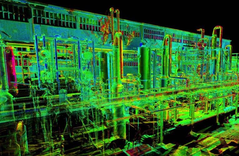
3D Laser Scanners utilizes non-contact
laser technology; generate highly detailed three-dimensional capture of complex
environments and geometries in a matter of minutes. Entire facilities can be
fully captured with great accuracy and no need for return site visits. 3D Laser
Scanning presents an ability to cost effectively produce comprehensive as-built
documentation with unparalleled speed and precision. Compared to the
traditional method of marking up old P&IDs and Plots Plans (if they are
available) and taking hand measurements, 3D scanning allows the digital
information to create a point cloud image which can be directly converted to a
3D model.
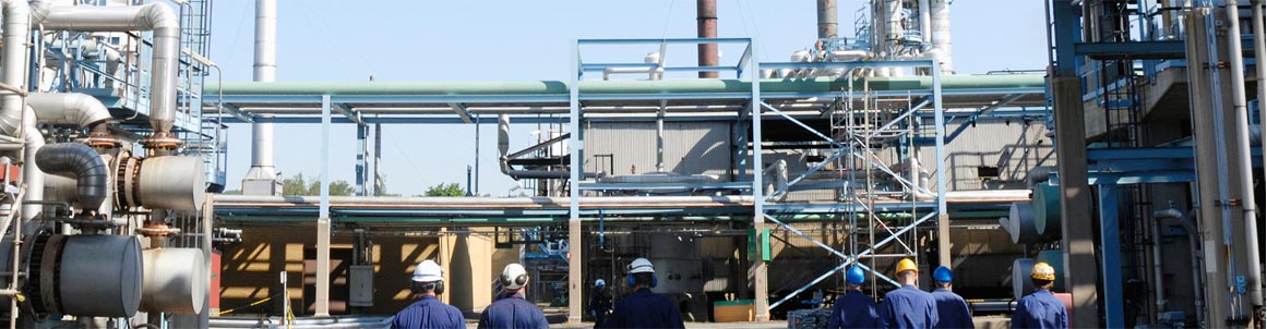
APC offers 3D Laser Scanning services to allow clients the
ability to easily ascertain the current status of equipment for maintenance or
production improvements in 3D space. This service is ideal for existing
facilities and pipelines when clients do not have recent or available design
drawings to move forward from. This is also an excellent tool for
producing as-built drawing packages.
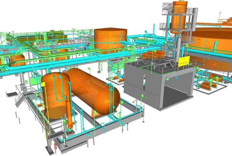
3D
Scan data can then be delivered to the client as Point Cloud Data or converted
to a 3D As built model for use with client's CAD package. Field Work Procedure
Laser Scans are captured from numerous locations, The scans are then registered
using X,Y,Z positions visible within each scan and previously recorded using a
Total Station or simply using overall Registration Option to get a local
coordinate system. This improves overall survey control and the accuracy of the
scan data. Individual scans may then be used or combined to form blocks of scan
data for further processing into an As built CAD model.
ADVANTAGES
•
Collect
Massive Amounts of Data for future use
•
Cost and
Schedule Reduction
•
Efficiently
capture all measurements for equipment, piping, electrical, structural
•
Field tie-ins
accurate within 3 mm accuracy
•
3D Scanning
and Modelling cost is similar or LESS than traditional as-building
•
3D Scanning
and Modelling accuracy is better than traditional as-building
•
Fewer
Man-Hours in the Field
•
Eliminate
return visits to site
•
Easily Convert
Point Cloud (Raw Data) into 3-Dimensional CAD Drawings & Models
•
Integrated
Software Platforms Ensure Accuracy and Efficiency
•
May be
integrated with GIS Systems
APPLICATIONS
3D
Laser Scanning provides measurement solutions to clients working in the
following sectors:
•
Oil Facilities
•
Gas Plants
•
Refineries
•
Pipelines
•
Factories